First Alert Forecast: Light winds, few showers... for now
Wet weather coming next week
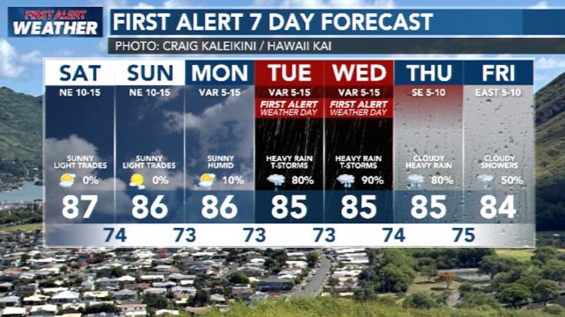
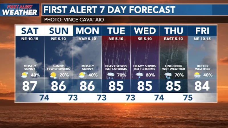
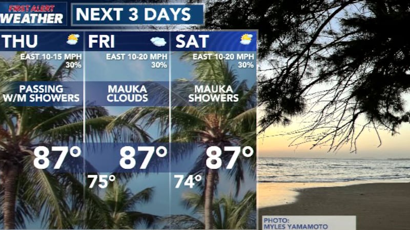
HONOLULU (HawaiiNewsNow) - The trade winds continue to trend lighter as we approach the weekend. Expect copious amounts of sunshine and just a few showers over the next four or five days. The showers will fall on windward and mauka neighborhoods nights and mornings. Some leeward areas will experience afternoon pop-up showers, but nothing heavy or long-lasting.
Low pressure developing to our southwest will change things as it moves closer. The light winds will shift to southeasterlies and it will feel sticky and muggy. It will also start to rain. Most rainfall models have the wet weather starting Tuesday afternoon/evening and continuing through Thursday. Accumulations are conservatively estimated in the 3-8″ range for the wet period. But the low may also bring thunderstorms and rainfall rates in the 2″ per hour category.
We will continue to fine-tune the forecast as we move forward.
Surf is smaller all around. Town is expecting a moderate swell this weekend. Country is expecting multiple swells over the next few days keeping wave heights about at seasonal average.
View the latest weather conditions here.
Download the HNN Weather app from the Apple App Store or Google Play for the latest updates from your First Alert Weather Team: chief meteorologist Jennifer Robbins and weather anchors Guy Hagi, Dan Cooke, Ben Gutierrez, and Billy V.

Copyright 2026 Hawaii News Now. All rights reserved.